Photos of Some of the Areas at Clifton, SC Affected by The Pacolet River Flood
Clifton Mill #1 began operation in 1881. It was followed by Mill #2 in 1887 and Mill #3 in 1895. In 1896, Victor Mill near Charlotte, NC was forced to close for three months. According to a newspaper article from the Charlotte Observer of August 16, 1896, many workers from Victor Mill went to Clifton to work in the new mill there. This was probably Clifton #3. Thanks to Robert Wells of Gastonia, NC for bringing this article to our attention. The article is as follows:
Victor Hands Migrate South
The Victor Mill shut down yesterday for three months. Over a hundred of the operatives leave to-day for Clifton, SC to work in the new mill at that place. Some go with and some with-out their household effects. The goods and chattels of some owing bills were attached yesterday.
( The workers who had their household goods seized probably had a bill at the Victor Mill company store.)
(The following recent photographs were taken by Bob Johnson and are used with his kind permission.)
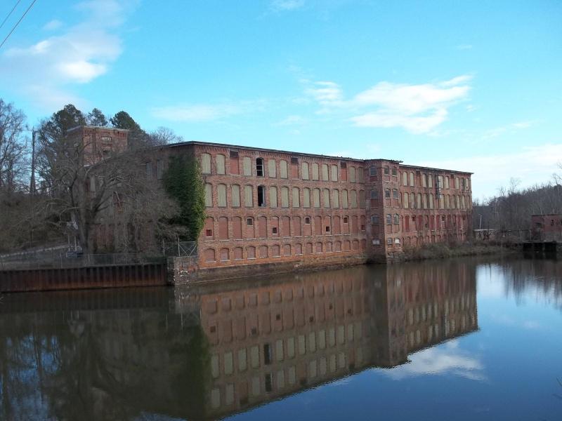
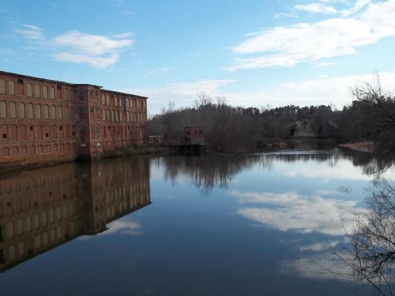
The mills and community of Clifton were devastated by the flood. The idle Clifton Mill #2, shown above, still stands beside the Pacolet River. Clifton Mill #1, located upstream, was destroyed in the flood. Mill #2 was badly damaged. Both mills were rebuilt. However, Mill #1 has been recently demolished. Many lives were lost at Clifton. This photo was taken looking downstream while standing on the bridge on the Clifton Glendale road. This photo was taken in December, 2011. There were plans to renovate part of the mill and use it for commercial purposes. However, in January, 2012, it was announced that the mill would be torn down and the area hopefully made into a nature preserve.
Slightly different view.
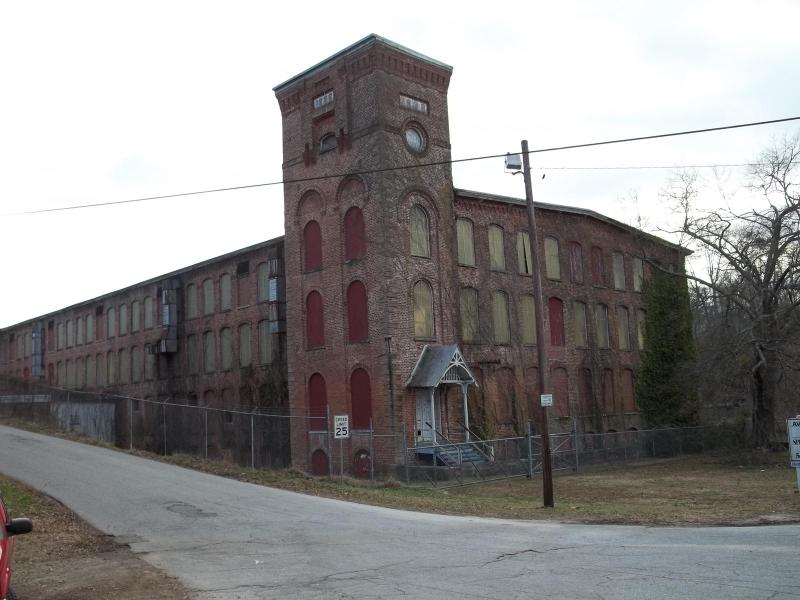
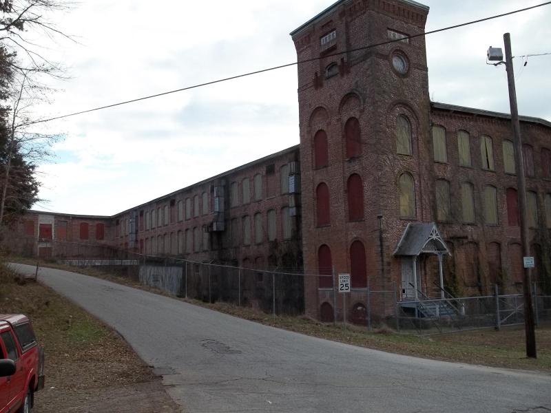
The tower of the front of mill #2 at the end of the bridge. The date on the tower is 1888. River Drive road runs alongside the mill and intersects with the Glendale - Clifton Road about where the photographer is standing. There was a portion of a Revolutionary War battle that took place near this spot.
Another view showing how close River Drive came to the Mill.
This view is standing in River Drive and looking back to the bridge and river which can be seen in the distance.
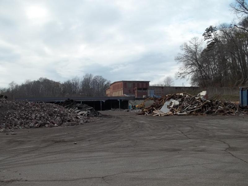
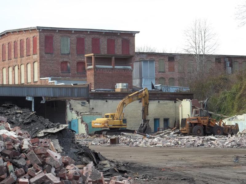
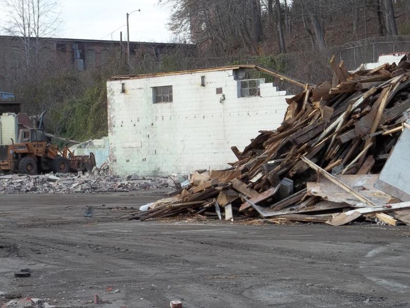
Part of Mill #2 is being demolished. The following 4 photos show some of this work.
The Pacolet River is to the left, out of sight.
The tower and River Drive are shown at a distance.
River Drive runs just outside the chain link fence shown.
This web site has been started as a public service to share the story of Pacolet.